


le Coudon

cousam
User
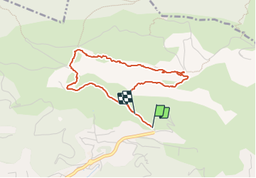

Length
4.1 km

Max alt
552 m

Uphill gradient
343 m
Km-Effort
8.7 km

Min alt
225 m

Downhill gradient
328 m
Boucle
No
Creation date :
2024-01-27 12:14:46.167
Updated on :
2024-01-27 17:20:14.159
2h54
Difficulty : Difficult

FREE GPS app for hiking
 SityTrail
IGN / Geographical institutes
SityTrail Plus
The world is yours!
About
Trail Walking of 4.1 km to be discovered at Provence-Alpes-Côte d'Azur, Var, La Valette-du-Var. This trail is proposed by cousam.
Description
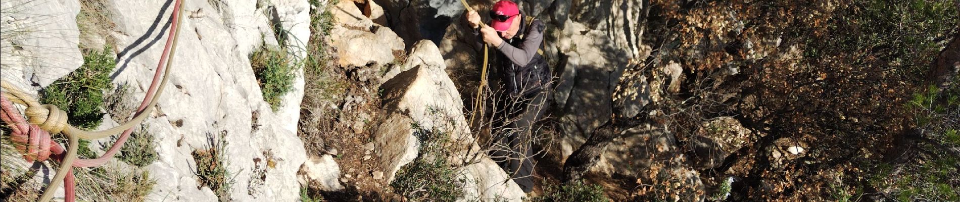
Passage hard avec cordes (bonnes prises)
Eventuellement prévoir baudrier corde pour assurer
Photos


Positioning
Country:
France
Region :
Provence-Alpes-Côte d'Azur
Department/Province :
Var
Municipality :
La Valette-du-Var
Location:
Unknown
Start:(Dec)
Start:(UTM)
743567 ; 4782356 (31T) N.
Comments